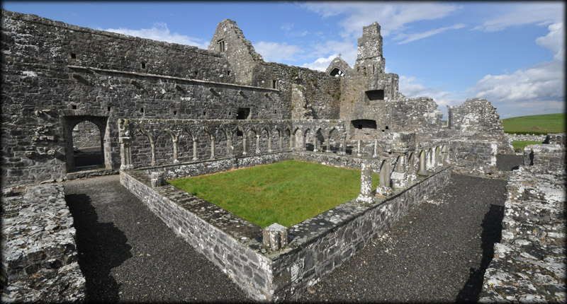
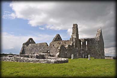
Clontuskert Augustinian Priory The Augustinian Priory of St Mary was founded in the 12th century by Turlough O'Connor, King of Connaught, possibly on the site of an earlier monastery founded by St. Baedán, who died circa 809. It was built in the claustral plan in which the church and domestic buildings of a monastery were arranged around a central cloister garth (garden), a practice that had become common for all religious orders since the rule of St Benedict in the early ninth century.
|
|
|---|---|
 |
|
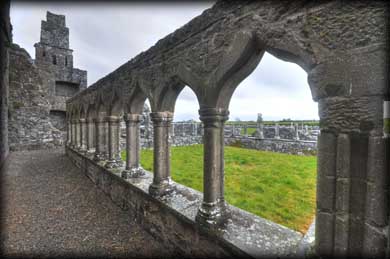
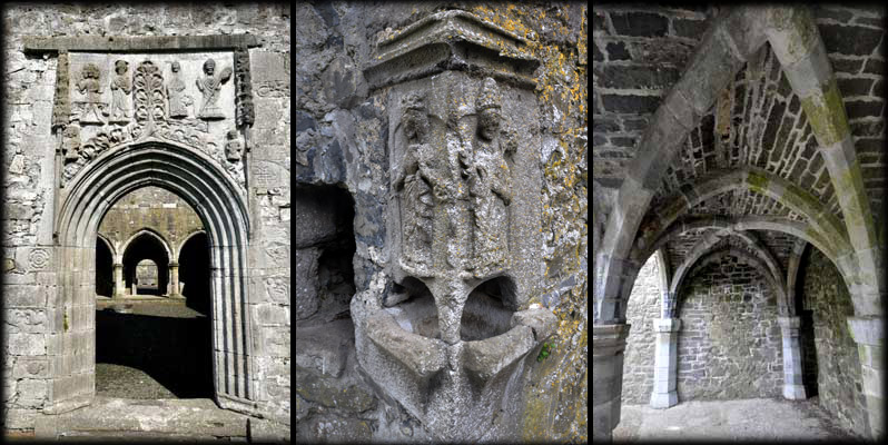
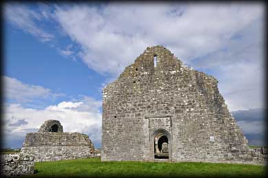
By the end of the 13th Century the monastery had become corrupt and was burned in the first decade of the 15th Century. It was rebuilt shortly afterwards when 10 year indulgences were granted to those who would contribute to its repair. One of the most impressive features of the new construction is the 4-order west doorway with its many carvings.
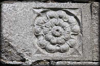
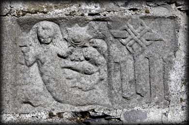
Among the carvings are St. Michael the Archangel with a sword and the scales for weighing souls, Saints Augustine, Catherine and St John the Baptist with a grape vine. On adjacent stones are carvings of a pelican feeding her young, a star, a pair of facing griffins, a dear and a dog, a rose, a bit of interlace, and a mermaid with a mirror similar to that found at Clonfert Cathedral. A similar door exists at Clonmacnoise. |
|
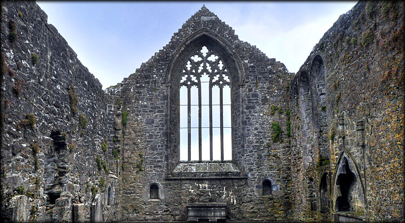
The fine east window, pictured above, and an unusual rood screen are also from the 15th Century. The east gable wall collapsed in 1918, destroying the east window. Luckily all the parts of the window were found in the rubble and were rebuilt 54 years after it collapsed. Clontuskert Priory is in a beautiful country setting. The walk to the Priory is about 100 metres along a straight track. We were blessed with good weather on our visit so the walk was quite enjoyable. We both agreed that the carvings were a sheer delight and the Priory was a joy to explore. |
|
Rose |
Mermaid |
Situated: Take exit 15 on the M6 and head south on the R355 for 5 kilometres the Priory is signposted on your left. Discovery Map 47: M 8562 2582. Last visit April 2012 Longitude: 8° 12' 56" W Latitude: 53° 16' 57" N Photos: Jim Dempsey and Deb Snelson. |
 |